Emory Center for Digital Scholarship’s Interactive Map of Big City
The process of creating this interactive map was made possible by the years of work that Anyabwile and Sims dedicated to the development of Big City’s mythology. In the gallery, you can view images of four maps that tell the story of how Big City came into existence and how its history is incorporated into the comic’s narratives.
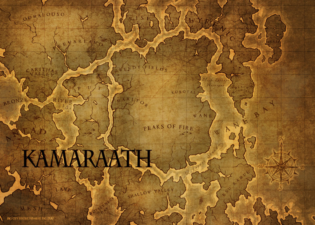
The first map is of Kamaraath, the original village founded by a character named Lyncean Big hundreds of years before Antonio Valor AKA Brotherman ever existed. This village developed over generations to include a large population, commerce, legal system, and a distinctive culture that would eventually be renamed Big City after its founder.
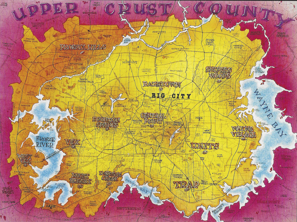
In issue #8 of the comic book series, “Sketches of the Sinister (1992),” the co-creators include the first iteration of the Big City map, titled Original Big City Map in the gallery. Here we see a drawing that includes named counties, roads, bodies of water, and land masses.
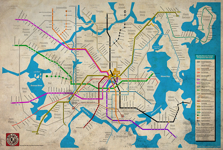
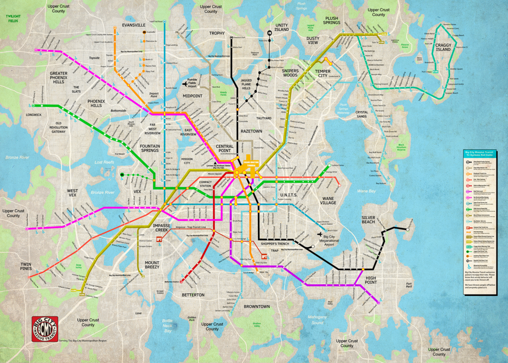
In the graphic novel, Brotherman: Revelation, the inside cover includes a digitally drawn map of Big City’s Massive Transit System. A close look at this map features multiple train lines, street names associated with each stop, as well as public accessibility signage. We used this existing map of the transit system and enhanced it so that it could be placed in the Tableau software.
The ECDS Interactive Big City Map includes streets, highways, and longitude/latitude coordinates for the city. We also worked to create a more realistic sense of spatial relationships between land, water, and population density. In addition, after reviewing the entire Big City Universe we identified 85 unique locations. The book’s author, Guy Sims, then created fictional addresses for each location. Each of these locations are searchable on the Tableau map and include annotations that can be scrolled over in the viewer. Finally, when a location is selected, an image of the issue cover and of the location within the comic book appears.


